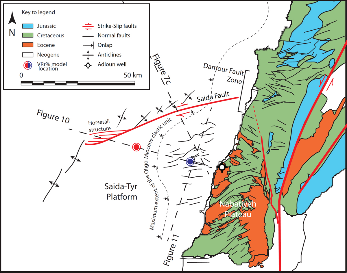
Dynamics of sedimentary basins and underlying lithosphere at plate boundaries: The Eastern Mediterranean
Open Access

Fig. 9

image

Download original image

Map showing the structures of the Levant margin south of Lebanon along both the STP and the Nabatiyeh Plateau. Check Figure 1 for location. Modified from Ghalayini et al. (2018). Red and blue dots mark the location of 1D burial model extracts presented in Figure 15 representing maturation trend for the distal and proximal STP, respectively.

Les statistiques affichées correspondent au cumul d'une part des vues des résumés de l'article et d'autre part des vues et téléchargements de l'article plein-texte (PDF, Full-HTML, ePub... selon les formats disponibles) sur la platefome Vision4Press.

Les statistiques sont disponibles avec un délai de 48 à 96 heures et sont mises à jour quotidiennement en semaine.

Le chargement des statistiques peut être long.