Dynamics of sedimentary basins and underlying lithosphere at plate boundaries: The Eastern Mediterranean
Open Access

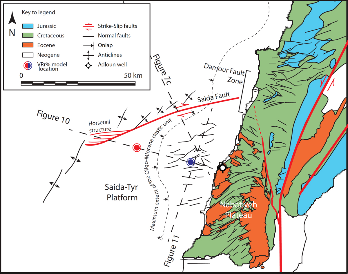
Fig. 9

image

Download original image

Map showing the structures of the Levant margin south of Lebanon along both the STP and the Nabatiyeh Plateau. Check Figure 1 for location. Modified from Ghalayini et al. (2018). Red and blue dots mark the location of 1D burial model extracts presented in Figure 15 representing maturation trend for the distal and proximal STP, respectively.

Current usage metrics show cumulative count of Article Views (full-text article views including HTML views, PDF and ePub downloads, according to the available data) and Abstracts Views on Vision4Press platform.

Data correspond to usage on the plateform after 2015. The current usage metrics is available 48-96 hours after online publication and is updated daily on week days.

Initial download of the metrics may take a while.