Fig. 14
Download original image
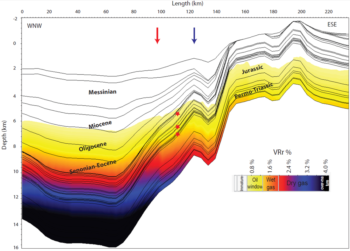
Onshore-Offshore cross-section featuring the modeled vitrinite reflectance (VRr%) with depth and the major stratigraphic intervals at present day (from Bou Daher et al., 2016). The location of this section is the same as that of Figure 10 with landward extension (shown in Fig. 9). The three stars represent the source rock intervals presented in Figure 15. Blue and red arrows represent the locations of the blue and red points in Figure 9 (indicating the proximal and distal locations for the 1D extracted vitrinite models.