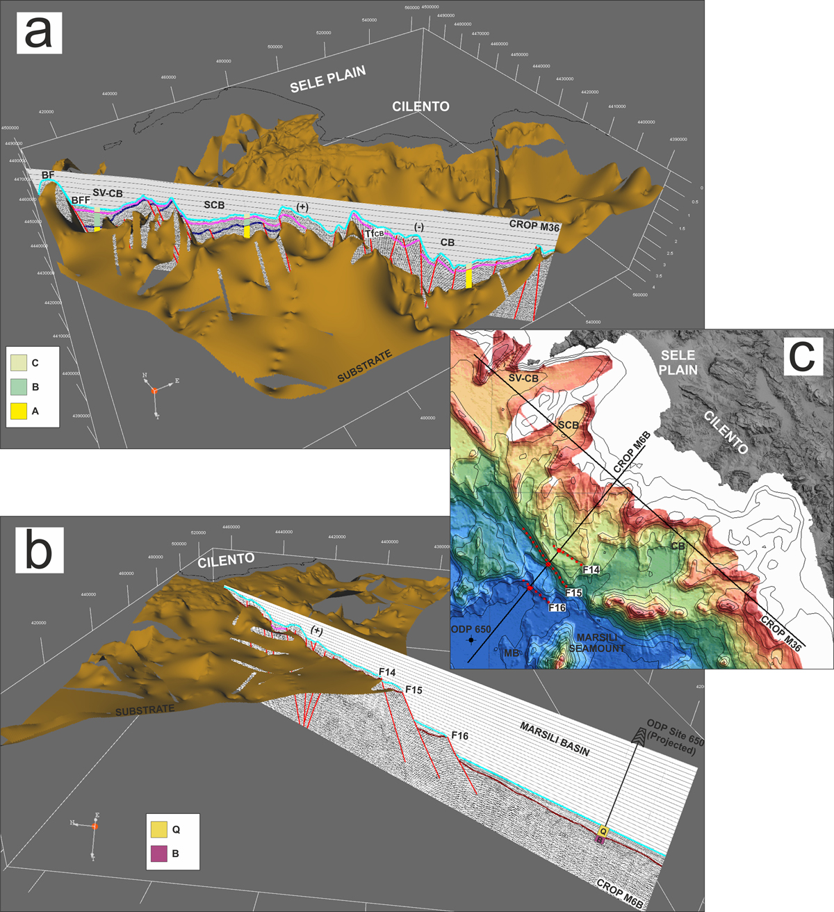
Fig. 10.
Download original image
(a, b) 3-D digital model inserted into the spatial-oriented grid of the SCM substrate and 3-D visualization of the interpreted seismic sections CROP M36 and CROP M6B. The view is from south-west and the vertical scale is in seconds. A = Unit A, B = Unit B, C = Unit C, BF = Banco di Fuori, BFF= Banco di Fuori Fault, TfCB= transfer fault Cilento Basin, SV-CB= Salerno Valley-Capri Basin, SCB = Salerno-Cilento Basin, CB = Cilento Basin, Q = Quaternary deposits, B = basalts, (+) = restraining bend, (−) = releasing bend. The seismic section M6B shows that the boundary between the Marsili Basin and the SCM corresponds to normal faults escarpment (F14, F15, F16; Sartori Lineament). (c) Multibeam map of the Tyrrhenian Sea from Marani et al. (2004).